Sekison-sama (Chiba Prefecture) Complete Guide: Thoroughly Explaining Sekison Mountain’s Climbing Routes, Access, and Attractions
Sekison Mountain (Sekisonyama), located in the central part of the Boso Peninsula in Chiba Prefecture, is known as a mountain of faith with a stone shrine enshrined at its 348-meter summit. Affectionately called “Sekison-sama,” this mountain is surrounded by one of the largest primeval forests in South Kanto and offers a valuable opportunity to enjoy quiet mountain walking. This article provides detailed explanations from the perspective of local climbers, covering everything from the mountain’s history to climbing routes, access methods, and nearby attractions.
What is Sekison-sama (Sekison Mountain)?
Sekison Mountain is located on the border between Kimitsu City Kiwada-hata and Otaki Town in Isumi District, Chiba Prefecture, forming part of the Boso Hills. The mountain’s name comes from the stone shrine called “Sekison-sama” enshrined at the summit, and it has long been an object of faith for local people.
Basic Information
- Elevation: 348m (some sources record it as 347m)
- Location: Kimitsu City and Isumi District Otaki Town, Chiba Prefecture
- Mountain Range: Boso Hills
- Map: Geospatial Information Authority 1:25,000 Topographic Map “Otaki”
- Best Climbing Season: Year-round (summer requires heat precautions, winter requires cold protection)
- Day Hike: Possible (estimated time: 3-5 hours)
Despite its low elevation, the mountain features steep slopes, narrow ridges, and rocky areas, offering varied climbing experiences for a Chiba Prefecture mountain.
History and Faith of Sekison-sama
At the summit of Sekison Mountain stands a stone shrine. This “Sekison-sama” has long been revered as an object of regional mountain faith. The Boso Peninsula has Sekison faith traditions scattered throughout the region, and Sekison Mountain is one such location cherished by local people.
Sekison faith is a belief system that venerates mountain gods and stone gods, serving as a place where people engaged in agriculture and forestry prayed for good harvests and safety. Today, the shrine at the summit is maintained by local residents, and climbers can often be seen quietly paying respects there.
Sekison Mountain Climbing Routes
Sekison Mountain has multiple climbing routes, with the primary one being the North Entrance approach. A ridge traverse to Hatsuhiyama and Daifukuyama is also popular.
North Entrance Approach Route (Most Common)
Trailhead: Via forest road from Kuratama District
Time Required: Round trip approximately 3-4 hours
Difficulty: Intermediate (steep slopes and rocky areas present)
Route Details
- Starting Point: Parking available around Kiwada-hata Furusato Fresh Products Store
- Forest Road Walk: Entering the forest road from Kuratama District, passing through the first tunnel and turning right onto the forest road
- Trail Entrance: The gate with vehicle barrier marks the beginning of the climbing trail
- Steep Slope Section: A narrow rocky ridge continues with careful footing required
- Summit Arrival: Stone shrine at the summit (limited views)
Sekison Mountain to Hatsuhiyama Ridge Traverse Route
Time Required: Round trip approximately 5-6 hours
Difficulty: Intermediate to Advanced (long distance, risk of getting lost)
This course traverses the ridge from Sekison Mountain to Hatsuhiyama in Mamenbara, a comfortable route through one of South Kanto’s largest primeval forests. However, the trail can be unclear in places, and carrying a map and compass or GPS app is recommended.
Ridge Traverse Characteristics
- Primeval Forest: A valuable area with natural forests of beech and Japanese beech remaining
- Quiet Environment: Few visitors, perfect for forest bathing
- Varied Terrain: Ridge trails and cliff-edge paths with changing landscapes
- Trail Confusion Points: Junctions and unclear sections require attention
Example Model Courses
Day-hike Roundtrip Course
- 09:00 Depart from Kiwada-hata Furusato Fresh Products Store
- 09:30 Trail entrance
- 11:00 Sekison Mountain summit (rest)
- 11:30 Begin descent
- 13:00 Return to trailhead
Ridge Traverse Course
- 08:00 Depart from Kiwada-hata
- 10:00 Sekison Mountain summit
- 12:00 Arrive at Hatsuhiyama (lunch)
- 14:00 Descend via Sekison Mountain
- 16:00 Return to trailhead
Access Methods
Access by Car
From Tokyo Area:
- Approximately 30-40 minutes from “Kimitsu IC” or “Ichihara Tsurumae IC” on the Tateyama Expressway
- Via National Route 410 heading toward Kiwada-hata
Parking:
- Around Kiwada-hata Furusato Fresh Products Store (confirmation required, consideration needed)
- Near forest road entrance in Kuratama District (limited spaces)
Public Transportation Access
Public transportation access is inconvenient. With limited bus service from nearby stations, car access is recommended.
Nearest Stations:
- Approximately 15km from JR Soto-Boso Line “Otaki Station” (by taxi)
- Approximately 20km from JR Uchibo Line “Kimitsu Station” (by taxi)
Attractions and Highlights of Sekison Mountain
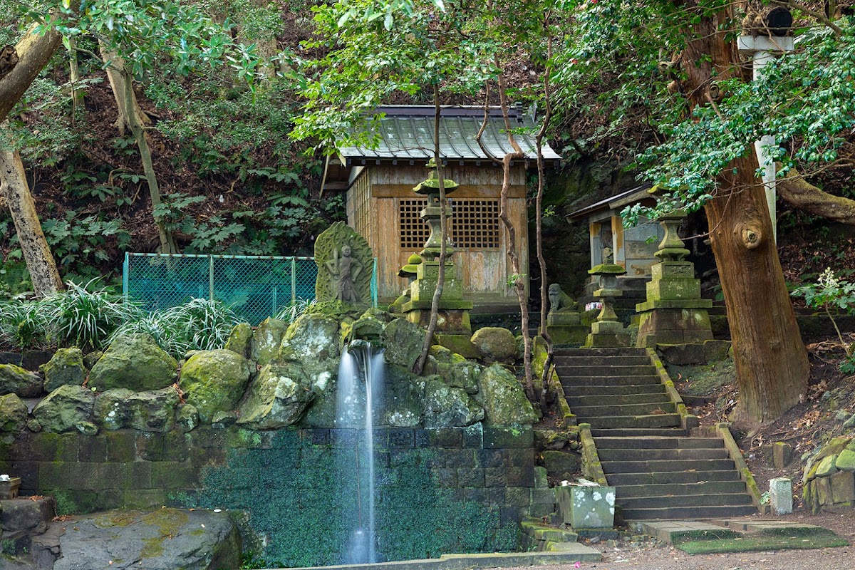
Stone Shrine at Summit
At the summit stands a stone shrine in quiet repose. Views are limited by surrounding trees, but the atmosphere as a place of faith is solemn. Many climbers can be seen praying for safe climbing in front of the shrine.
South Kanto’s Largest Primeval Forest
The area from Sekison Mountain to Hatsuhiyama is home to one of South Kanto’s most significant remaining primeval forests. Natural forests of beech, Japanese beech, fir, and other species spread throughout, showing different characteristics in each season.
- Spring: Beautiful fresh greenery, bird songs
- Summer: Deep green and cool tree shade
- Autumn: Colorful autumn leaves
- Winter: Open forest views after leaf fall
Quiet Climbing Environment
Sekison Mountain is relatively obscure within Chiba Prefecture, and even on weekends, few climbers are encountered, allowing for quiet mountain walking. It’s ideal for those wanting to escape the hustle and bustle and connect with nature.
Climbing Precautions
Equipment and Preparation
- Hiking Boots: Sturdy hiking boots are necessary due to rocky areas and steep slopes
- Map/GPS: Essential due to unclear sections of trail
- Water and Food: Carry sufficient quantities
- Rain Gear: Prepare for weather changes
- Headlamp: Check sunset times and maintain adequate schedule
Beware of Getting Lost
Especially on the ridge traverse, there are junctions and unclear sections. Check maps beforehand and reference other climbers’ records on apps like YAMAP and YamaReco.
Seasonal Precautions
- Spring to Summer: Insect repellent, heat stroke prevention
- Autumn: Beware of Japanese hornets
- Winter: Pay attention to time management due to early sunsets
Combination Climbing with Nearby Mountains
Several mountains near Sekison can be combined with climbing Sekison.
Hatsuhiyama
Connected to Sekison Mountain by a ridge traverse. Near Mamenbara Highland, it is also known as a hydrangea viewing spot.
Daifukuyama
One of the representative mountains of the Boso Peninsula, sometimes climbed together with Sekison Mountain. It offers good views and hosts maintenance climbing events.
Mitsuishiyama
Located north of Sekison Mountain, sometimes visited when touring the Boso Hills mountains.
Kiyosumiyama
A representative mountain of the Boso Peninsula, famous for Kiyosumi Temple. Though somewhat distant from Sekison Mountain, it should be considered when touring the Boso region.
Seasonal Enjoyment
Spring (March-May)
The new greenery season offers beautiful budding and bird songs. Comfortable temperatures make it ideal for climbing.
Summer (June-August)
Deep green forests provide excellent forest bathing. Though low elevation means heat, tree shade is relatively cool. Early morning starts are recommended.
Autumn (September-November)
The autumn foliage season features beautiful primeval forest colors. Comfortable temperatures make it arguably the best climbing season.
Winter (December-February)
After leaf fall, visibility improves for winter landscape views. Little snow accumulates in low Chiba mountains, though cold protection is necessary. Pay attention to time management due to early sunsets.
Actual Comments from Sekison Mountain Climbers
Climbing record sites feature numerous comments from those who visited Sekison Mountain.
- “After a long hike around the circuit from Sekison to Hatsuhiyama, I fully enjoyed the forest bathing through the primeval forest path”
- “Visited on New Year’s—quiet with no one else there. I carefully navigated the steep slopes and rocky narrow ridge”
- “The trail was unclear in places and I got lost several times. GPS is essential”
- “Summit views are not expected, but quiet mountain walking is enjoyable”
These comments convey Sekison Mountain’s characteristics: “quiet environment,” “beautiful primeval forest,” and “difficult trail navigation.”
Nearby Facilities and Nearby Spots
Kiwada-hata Furusato Fresh Products Store
A store near the trailhead selling fresh local vegetables and specialty products. Recommended as a post-climb stop.
Mamenbara Highland
A highland in the direction of Hatsuhiyama on the ridge traverse, known as a hydrangea viewing spot. Around early July, approximately 20,000 hydrangea plants bloom.
Yoro Valley
A valley about 30 minutes by car from Sekison Mountain, famous as an autumn foliage viewing spot. Recommended to visit in combination with climbing.
Maps and Navigation
The following maps and apps are recommended for Sekison Mountain climbing.
Paper Maps
- Geospatial Information Authority 1:25,000 Topographic Map “Otaki”
- “Boso Hills” Mountain and Highland Map (Shobunsha)
Climbing Apps
- YAMAP: Mapping app usable offline. Many activity records of Sekison Mountain posted
- YamaReco: Climbing record sharing site. Other climbers’ route information is helpful
- Sanyaryo: Mountain basic information and weather information available
These apps allow you to reference other climbers’ records in advance to help plan routes and estimate time.
Weather and Meteorological Information
Since Sekison Mountain has low elevation, extreme weather conditions are rare, but checking weather is basic mountain climbing practice.
Weather Forecast Checking Methods
- Japan Meteorological Agency forecasts (Kimitsu City and Otaki Town)
- Mountain weather information from climbing apps
- “Tenki to Kurasu” (Climbing Index)
Annual Meteorological Trends
- Precipitation: Heavy during June-July rainy season and September-October typhoon season
- Temperature: Exceeds 30°C on summer days, rarely freezes in winter
- Wind: Wind strengthens on ridges, requiring caution
Best Season for Sekison Mountain Climbing
While Sekison Mountain is climbable year-round, the recommended times are:
- October-November (Autumn): Beautiful fall foliage and comfortable temperatures
- April-May (Spring): Enjoy fresh greenery and bird songs
- December-February (Winter): Clear air provides good visibility, fewer climbers
Summer climbing is possible but requires heat precautions and early morning starts.
Climber Distribution and Congestion
Sekison Mountain is relatively obscure in Chiba Prefecture, and even weekends see little congestion. Quiet climbing is enjoyed year-round, though climber numbers tend to increase during:
- Autumn foliage season (November)
- Golden Week
- Year-end and New Year holidays
However, compared to famous mountains, crowds remain minimal, with reports of “meeting no one” being common.
Summary: Charm of Sekison-sama
Chiba Prefecture’s Sekison Mountain (Sekison-sama), despite its low 348-meter elevation, possesses the following attractions:
- Quiet Climbing Environment: Few visitors allow communion with nature
- Primeval Forest Beauty: A valuable area with South Kanto’s largest remaining natural forest
- Religious History: Feel the region’s history at the summit’s Sekison-sama
- Varied Terrain: Steep slopes, rocky areas, and narrow ridges provide diverse climbing
- Ridge Traverse Enjoyment: Possible traverse to Hatsuhiyama and Daifukuyama
For those seeking serious mountain walking in Chiba Prefecture or wanting to refresh in quiet natural surroundings, Sekison Mountain is an excellent choice. However, some trail sections are unclear, so carrying maps and GPS apps and making thorough preparations is essential.
Experience the deep nature of the Boso Peninsula at Sekison-sama. Why not visit this quiet mountain on your next day off?
Frequently Asked Questions (FAQ)
Q1. How do you read Sekison Mountain?
A1. Sekison Mountain is read as “Sekisonyama.” Locally, it is also called “Sekison-sama” with affection.
Q2. Can beginners climb it?
A2. With steep slopes, rocky areas, and narrow ridges, it may be challenging for complete beginners. Those with basic climbing experience and good physical fitness can attempt it. If uncertain, climbing with experienced people is recommended.
Q3. How long does it take to climb?
A3. The roundtrip North Entrance route takes approximately 3-4 hours, and including the Hatsuhiyama ridge traverse, approximately 5-6 hours roundtrip. Time varies with rest breaks and individual fitness, so plan with flexibility.
Q4. Is there parking?
A4. There is no dedicated climber parking, but parking spaces exist around Kiwada-hata Furusato Fresh Products Store and near the forest road entrance in Kuratama District. Care should be taken not to inconvenience local residents.
Q5. Are there summit views?
A5. Unfortunately, the summit is surrounded by forest, so views are almost non-existent. Sekison Mountain’s appeal lies more in quiet hiking through the primeval forest and the summit’s Sekison-sama than in views.
Q6. Are there toilets?
A6. No toilets exist on the climbing trail. It’s recommended to use facilities at Kiwada-hata Furusato Fresh Products Store or rest areas before climbing.
Q7. Does cell phone service work?
A7. Some areas have weak signal reception. As a precaution, inform family or friends of your destination before climbing.
Q8. Is it safe to climb alone?
A8. With unclear trail sections, solo climbers must especially carry maps and GPS apps. Submit a climbing notification and inform family or friends of your destination. Multi-person climbing is safer when possible.