Thorough Explanation of the Origin and History of the Placename and Surname Kutanda (Long Prefecture)
The placename and surname Kutanda are fascinating entities deeply connected to Japanese history. There is a particularly strong relationship with Nagano Prefecture, and its origins reflect the region’s history and culture vividly. This article provides a thorough explanation of detailed information related to Kutanda from both the perspective of a placename and the perspective of a surname.
Basic Information About the Name Kutanda
Kutanda (くたんだ, くたんた) is primarily a placename and surname with origins in Nagano Prefecture. The unit “Kutanda” is a traditional Japanese unit of land area, where one tan (反) refers to approximately 991.7 square meters (approximately 300 tsubo). In other words, Kutanda is thought to be a placename-derived name meaning “nine tan of rice paddy.”
Variations in Reading
The name Kutanda has multiple reading patterns:
- Kutanda (most common)
- Kutanta
- Kutanden
These differences in reading reflect the history of changes that have occurred across regions and time periods.
Historical Background of Kutanda in Nagano Prefecture
Connection to Shinano Province Takai District
According to historical records, the placename Kutanda is said to have come from Kutanda Village (Kutanda-mura) in what is now Takai District of Shinano Province, corresponding to present-day Nagano Prefecture. Takai District corresponds to the northern part of present-day Nagano Prefecture, particularly the areas around Nakano City and Yamanouchi Town.
Shinano Province was an important agricultural region from ancient to medieval times, and Takai District in particular was known as fertile land in the Chikuma River basin. The fact that someone owned rice paddies on the scale of nine tan suggests they were from a family with considerable economic power.
Changes from Medieval to Early Modern Periods
In medieval Shinano Province, land reclamation and expansion of agricultural production progressed. The placename Kutanda is likely named to indicate the size of newly reclaimed rice paddies during this period.
During the Sengoku period, Shinano Province became a battleground for powerful daimyo such as the Takeda and Uesugi clans. With the start of the Edo period, Takai District came under the control of clans such as the Matsushiro and Iiyama domains, and through land surveys (kenchiku), land areas were measured with precision. It is presumed that the placename Kutanda was recorded in official documents during this process.
The Origin and Characteristics of the Surname Kutanda
Surname Derived from a Placename
The surname Kutanda is a typical example of a surname derived from a placename. Many Japanese surnames came to be used based on the characteristics or placenames of the land where the family lived. The family that adopted the Kutanda surname is thought to have originated from either having owned rice paddies on a scale of nine tan or having lived in a place named Kutanda.
Distribution of the Surname
The distribution of the Kutanda surname in modern times is extremely limited. Even viewed nationally, it is a very rare surname, found primarily in the following regions:
- Kumamoto Prefecture – the prefecture where it is currently most widely distributed
- Nagano Prefecture – the historical place of origin
- Other regions – scattered small numbers elsewhere
Interestingly, it is more widely distributed in Kumamoto Prefecture than in Nagano Prefecture, where it originated. This is thought to be due to population movements from the Edo period through the Meiji period, particularly migration in search of development opportunities and work.
Rarity and Characteristics
The Kutanda surname is one of the extremely rare surnames in all of Japan. It ranks low on surname rankings, with an estimated several dozen households nationwide. Such rarity indicates that the region that became the origin of the surname was limited in scope, and that branch families and relocations were few.
Placenames Related to Kutanda Within Nagano Prefecture
Kutanda District in Nagano City
The placename “Kutanda” currently exists in Nagano City, Nagano Prefecture. This is a placename that may be related to Kutanda. Kutanda District in Nagano City is located near Nagano Station and has developed as an urban area.
Characteristics of this area:
- Access: Within walking distance of Nagano Station
- Geographical features: Flat land in the Chikuma River basin
- History: A former agricultural area that has undergone urbanization
Other Related Placenames
Multiple placenames indicating land area exist within Nagano Prefecture:
- Sannanda (santan-da)
- Gotanda (gotan-da)
- Shichitanda (shichitan-da, nanatan-da)
These placenames directly indicate the size of reclaimed rice paddies, and Kutanda is thought to follow the same naming conventions.
Historical Significance of the Placename Kutanda
“Tan” as a Unit of Land Area
The “tan” (反), a traditional unit of land area in Japan, was an extremely important concept in an agricultural society. One tan is:
- Area: Approximately 991.7 square meters (approximately 300 tsubo)
- Rice production: Approximately 150 kg (about one koku)
- Significance: Approximately 1/10 of the minimum unit needed to sustain one family
With nine tan of land, one could expect a reasonable agricultural income. This suggests that such a person was a farmer with a certain standing in regional society from the medieval to early modern period.
History of Land Survey and Measurement
The fact that the placename Kutanda was recorded in historical documents stems from Hideyoshi Toyotomi’s great land survey (Taikō Kenchi) and the Edo shogunate’s land survey system. Through these surveys:
- Land areas were measured with precision
- Standards for tribute payments became clarified
- Placenames were preserved as official records
The placename Kutanda likely became established as an official placename through such survey processes.
Characteristics of Families with the Kutanda Surname
Presumed Background of the Family Line
Families that adopted the Kutanda surname are presumed to have had the following characteristics:
- Agricultural managers: Economic power sufficient to own rice paddies on a scale of nine tan
- Local figures: Positions with a certain voice in village society
- Settled populations: Long-term residents of specific lands
Possible Family Crests
Information about the family crests of the Kutanda surname is limited, but possible crests commonly seen among agricultural surnames in Nagano Prefecture include:
- Rice plant crest (rice ears stylized)
- Hawk feather crest
- Small herb (kikyo) crest
- Plum blossom crest
However, these vary by individual families, so no definitive statement can be made.
Information Search and Research Methods for Kutanda in Modern Times
Methods for Researching Kutanda as a Placename
The following methods are effective for researching placenames related to Kutanda within Nagano Prefecture:
- Using map services: Search for “Kutanda” or “Kutanda-ta” on electronic maps
- Address searches: Verify address information such as Kutanda, Nagano City, Nagano Prefecture
- Researching historical materials: Consulting local history materials and old maps
- On-site investigation: Gathering regional information by actually visiting Nagano Prefecture
Methods for Researching Kutanda as a Surname
To research the Kutanda surname in greater detail:
- Using surname origin websites: Searching specialized surname databases
- Family registry investigation: Obtaining family registries for genealogy creation
- Local history research: Investigating local history materials from Nagano and Kumamoto prefectures
- DNA testing: Using cutting-edge methods to explore genetic roots
Accessing Historical Materials about Nagano Prefecture
The following facilities and services are useful when researching historical information about Nagano Prefecture:
- Nagano Prefecture Historical Museum: Houses historical materials from the prefecture
- Municipal libraries: Browse regional materials in the local history section
- Digital archives: Search for old documents and maps online
- University libraries: Access to specialized research materials
Geographic Features of Nagano Prefecture Related to Kutanda
Agricultural Area in the Chikuma River Basin
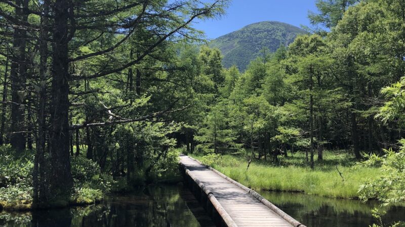
Placenames related to Kutanda in Nagano Prefecture are primarily located in the Chikuma River basin. Characteristics of this area:
- Fertile soil: Nutrient-rich earth transported by river flooding
- Good water access: Easy securing of irrigation water
- Flat terrain: Large-scale paddy field development possible
- Climate: Basin-specific temperature variations suitable for rice cultivation
Historical Importance of Takai District
Takai District of Shinano Province has been known as an important agricultural area since ancient times:
- Ancient period: One of the important districts under the ritsuryo system
- Medieval period: Strategic location in the northern part of the Zenkoku-ji Plain
- Early modern period: Developed as territory of the Matsushiro and Iiyama clans
- Modern era: Region including Nakano City, Yamanouchi Town, and others
Distribution and Movement of the Kutanda Surname in Modern Times
History of Migration to Kumamoto Prefecture
Several historical backgrounds can be considered for migration to Kumamoto Prefecture, where the Kutanda surname is currently most widely distributed:
- Meiji-period development: Migration to the Kyushu region concurrent with Hokkaido development
- Migration in search of work: Population movement accompanying industrial development
- Kinship relations: Migration through marriage
- Post-war population movement: Labor force migration during the period of high economic growth
Characteristics of Modern Distribution
The modern distribution of the Kutanda surname has the following characteristics:
- Extremely small number: Approximately several dozen households nationwide
- Regional concentration: Concentrated in specific prefectures
- Movement to urban areas: Migration trend from rural to urban areas
- Maintained rarity: Limited population growth preserves rarity
Cultural Value of the Placename and Surname Kutanda
Witness to Agricultural History
The name Kutanda is a valuable cultural heritage that tells the story of Japanese agricultural history. Placenames that directly indicate land area serve as important clues for understanding the scale of agricultural management and social structures at the time.
Source of Regional Identity
As an extremely rare surname, Kutanda serves as a source of strong regional identity for those who bear it. The historical background of having roots in Nagano Prefecture is passed down as a source of family pride.
Linguistic Value
The placename and surname Kutanda are excellent examples of Japanese placename-naming conventions. The structure of numerals (nine) + units (tan) + landforms (paddy) reflects the logical naming system common to Japanese placenames.
Future Issues in Kutanda Research
Need for Further Historical Investigation
Many points about Kutanda remain unexplained:
- Specific geographic location: Determining the precise location of Kutanda Village in Takai District of Shinano Province
- Time of first appearance: Identifying when it first appeared in literature
- Family details: Identifying the first family to adopt the Kutanda surname
- Details of migration: Detailed circumstances of migration from Nagano to Kumamoto Prefecture
Application of Digital Technology
Modern digital technology has the potential to bring Kutanda research to a new stage:
- GIS (Geographic Information Systems): Precise location identification of historical placenames
- Digitization of old documents: Improved online access to materials
- DNA analysis: Clarification of genetic roots of family lines
- Big data analysis: Statistical analysis of surname distribution patterns
Comparison with Other Characteristic Placenames in Nagano Prefecture
Nagano Prefecture contains numerous placenames that, like Kutanda, indicate land area or characteristics:
Placenames Indicating Area
- Ittanda (一反田): Rice paddy of one tan area
- Gotanda (五反田): Rice paddy of five tan area
- Hyakucho (百町): Vast land of one hundred cho area
Comparing these with Kutanda clarifies that Kutanda indicates medium-sized farmland.
Placenames Indicating Landforms
Nagano Prefecture also has abundant placenames indicating geographical characteristics:
- Kawaigoshindan: New paddy where rivers merge
- Chikuma: A meandering river
- Zenkoku-ji Plain: Plain area centered on Zenkoku-ji Temple
By comparing these with Kutanda, the position of Kutanda within Nagano Prefecture’s placename system becomes clear.
Tourism Information When Visiting Kutanda
Access to Kutanda District in Nagano City
When visiting Kutanda District in Nagano City, Nagano Prefecture:
- Railway: Within walking distance from JR Nagano Station or Kitashinano Line Nagano Station
- Automobile: Approximately 10 minutes from Nagano IC
- Bus: Available via city buses from Nagano Station
Nearby Tourist Attractions
Major tourist attractions of Nagano City are concentrated around Kutanda District:
- Zenkoku-ji Temple: Ancient temple with National Treasure main hall
- Around Nagano Station: Urban shopping and dining area
- Chikuma River: Scenery of one of Japan’s longest rivers
- Matsushiro Castle Ruins: Historic site related to the Sanada clan
Facilities for Local History Research
For those wishing to deepen their knowledge of Kutanda’s history:
- Nagano Prefecture Historical Museum: Comprehensive display of prefectural history
- Nagano City Museum: Introduction to local history and culture
- Various local libraries: Local history materials available for consultation
Conclusion: Japanese History and Culture as Told by Kutanda
The placename and surname Kutanda, while appearing simple at first glance, condenses Japanese agricultural history, social history, and linguistic history within it. Originating from Takai District, Shinano Province in Nagano Prefecture, this name indicating the specific land characteristic of rice paddies of nine tan scale is a valuable cultural heritage that conveys to the present day the image of Japan’s rural society from medieval to early modern times.
In modern times, an extremely small number of people primarily in Kumamoto Prefecture bear the Kutanda surname, and due to its rarity, interest in family history has increased. In this modern age, when access to old documents and historical materials has become easier due to the development of digital technology, research into place-based names such as Kutanda may enter a new phase.
When visiting Nagano Prefecture, why not visit Kutanda District and its surroundings and reflect on the historical background in which this placename was born? Through the name Kutanda, the fertile land of the Chikuma River basin and the history of the lives of people who lived there will surely speak to us.