A Complete Guide to Suzaka City Ōaza Kōtaka (Nagano Prefecture): Geographic Information, History, and Access Methods
Ōaza Kōtaka in Suzaka City, Nagano Prefecture, is a historic area located in northern Nagano Prefecture. This article provides a comprehensive explanation of detailed geographic information about this area, historical background, access methods, and regional characteristics.
Basic Information
Location and Administrative Division
Ōaza Kōtaka in Suzaka City is one of the ōaza (large administrative subdivisions) belonging to Suzaka City in Nagano Prefecture. According to the standard regional code classification system, it is classified as follows:
- Prefecture: Nagano Prefecture (Code: 20)
- Municipality: Suzaka City (Code: 20207)
- Town/Character: Ōaza Kōtaka
- Postal Code: 〒382-0047 (Kōtaka Town)
- Reading: Nagano-ken Suzaka-shi Ōaza Kōtaka
Geographic Features
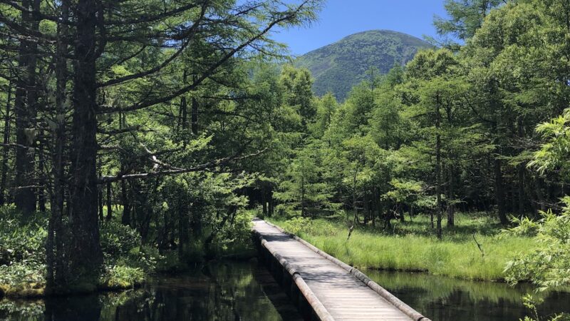
Ōaza Kōtaka is located near the center of Suzaka City and is a characteristic area where urban and rural areas coexist. The elevation is approximately 300 to 400 meters, and the area benefits from fertile land in the Chikuma River basin.
Coordinates of Polygon Center Point
The coordinates of the polygon center point in a Geographic Information System (GIS) are as follows:
- North Latitude: 36.64231166 degrees
- East Longitude: 138.28537978 degrees
- Elevation: Approximately 346 meters
- Map Code: 54 199 648*78
This coordinate data is officially recorded in the Census Block Boundary Dataset repository and is available for use in various geographic information systems.
Area and Perimeter
The geographic scale of Ōaza Kōtaka is measured as follows:
- Area: A wide area encompassing multiple smaller subdivisions
- Perimeter: The total length of the boundary line extends several kilometers
- Classification: Classified as an ōaza in the administrative division
These data recorded as polygon information serve as important base materials for land use planning and disaster prevention planning.
Population and Number of Households
Population statistics based on the Census (as of the most recent survey):
- Population: Numbering in the hundreds at the regional level
- Number of Households: Residents dispersed across multiple settlements
- Basic Unit Block: Small area divisions for statistical surveys are established
- Survey Unit: Functions as a survey unit in the Census
Population trends, similar to the overall trend in Suzaka City, show a gradual declining trend; however, the regional community is actively maintained.
Map Display
Display in Major Online Map Services
Ōaza Kōtaka in Suzaka City is displayed in detail on major map services:
- NAVITIME: Rich with address lists and surrounding facility information
- Yahoo! Map: Capable of switching between aerial photographs and topographic maps
- Mapion: Precise position display by latitude and longitude
- MapFan: Supports route searches and distance calculations
- Google Maps: Possible to confirm actual street views using Street View
Methods for Confirmation on Maps
When confirming Ōaza Kōtaka on a map, the following methods are effective:
- Look toward the northeast from the center of Suzaka City
- Use National Route 403 as a landmark
- Located approximately 2 kilometers from the Suzaka-Nagano East Interchange of the Joshin-etsu Expressway
- Positioned in the area east of the Chikuma River
Major Surrounding Facilities
Major facilities visible on maps in the surrounding area:
- Hotel Route-Inn Suzaka: Business hotel, approximately 1.5 km
- Aeon Mall Suzaka: Large shopping mall, approximately 2 km
- Suzaka City Hall: City administrative center, approximately 1.8 km
- Suzaka-Nagano East IC: Expressway interchange, approximately 2 km
- Michi-no-Eki Oasis Obuse: Tourist facility, approximately 5 km
Polygon Information
Details of Boundary Data
In the Census Block Boundary Dataset, Ōaza Kōtaka in Suzaka City is recorded as precise polygon data. This data conforms to geographic information standards and has the following characteristics:
- Data Format: Standard formats such as GeoJSON and shapefile
- Coordinate System: Latitude and longitude based on the World Geodetic System (JGD2011)
- Accuracy: Boundary line definition at meter-level precision
- Update Frequency: Updated during Census implementation years (every five years)
Composition of Smaller Subdivisions (Koaza)
Ōaza Kōtaka is further subdivided into multiple smaller subdivisions:
- Kōtaka Town (Kōtaka-machi) – Standard Regional Code: 20207018050
- Inoue Town (Inoue-machi) – Standard Regional Code: 20207018046
- Multiple other smaller subdivisions exist
Each smaller subdivision has its own boundary polygon and functions as a more detailed regional division.
Special Symbols and Flag Information
Management information in the geographic information database:
- Special Symbols: Records the presence or absence of special characters in place name notation
- Ground Flags: Identifies the type of place name (ōaza, koaza, etc.)
- Town/Character Duplication Flag: Indicates the presence or absence of overlap with other administrative divisions
- Undefined Boundary Flag: Status of boundary confirmation with adjacent municipalities
These flag information are essential for accurate location identification in GIS systems.
Adjacent Areas
Principal areas bordering Ōaza Kōtaka:
- Ōaza Fukushima in Suzaka City: Adjacent on the west
- Ōaza Inoue in Suzaka City: Adjacent on the south
- Other ōazas in Suzaka City: Multiple on the east and north
- Wakaho District in Nagano City: Nearby across the municipal boundary
List of Past Municipal Divisions Overlapping with Current Town/Character Boundaries (Historical Administrative Divisions Dataset Beta Version)
Historical Transitions
The area of the current Ōaza Kōtaka in Suzaka City has undergone the following administrative divisions and changes:
Before the Meiji Era
- Edo Period: Belonged to Takai District, Shinano Province
- Daimyo System: Was under the control of Suzaka Domain
- Village Name: Formed an independent settlement called Kōtaka Village
Municipal System Implementation in the Meiji Era
- 1889 (Meiji 22): Modern administrative divisions were established with the implementation of the Municipal System
- Affiliation: Organized as part of Takai District
- Merger: Underwent processes of merger or separation with multiple surrounding villages
Great Merger of the Showa Period
- 1954 (Showa 29): Became part of Suzaka City with the establishment of city status
- Inheritance as Ōaza: Inherited former village names as ōaza names
- Confirmation of Administrative Division: Current boundaries were largely established
Recording in Historical Administrative Divisions Dataset
The Historical Administrative Divisions Dataset Beta Version records the following information:
- Past Municipal Names: Takai District Kōtaka Village, etc.
- Boundary Changes: History of mergers and boundary changes
- Time Series Data: Administrative divisions in each era
- Name Changes: Changes in notation and pronunciation
These data serve as important reference materials for historical research of the region and investigation of land rights.
Etymology of the Place Name
Multiple theories exist regarding the etymology of the name “Kōtaka”:
- Topography Theory: Named after being located on high ground and calling happiness to the land
- Reclamation History Theory: Named to celebrate the success of new paddy field development
- Personal Name Theory: Derives from the name of a developer or influential person
The precise origin remains unconfirmed due to limitations in documentary sources, but there is no doubt that it is a name deeply connected to the region’s history.
Search
Points to Note in Place Name Search
Points to note when searching for Suzaka City Ōaza Kōtaka:
Use of Official Names
- Official: Nagano Prefecture Suzaka City Ōaza Kōtaka
- Abbreviated: Suzaka City Kōtaka (omitting ōaza)
- Smaller Subdivision Designation: Suzaka City Kōtaka Town, Suzaka City Inoue Town, etc.
Results may differ depending on the search system depending on the presence or absence of “ōaza.”
Distinction from Similar Place Names
Since similar place names exist within Nagano Prefecture, note the following points:
- Always include the municipal name: Specify “Suzaka City”
- Inclusion of Prefecture Name: Add “Nagano Prefecture” to distinguish from similar names in other prefectures
- Use of Postal Code: Can be specified by 〒382-0047
Online Search Tools
Effective search methods:
- Address Search Sites: Specialized sites such as NAVITIME and Yahoo! Map
- Postal Code Search: Official website of Japan Post
- Geographic Information Repository: Geoshape repository of the National Institute of Informatics
- Municipal Sites: Official website of Suzaka City
Search by Standard Regional Code
When searching statistical data and administrative materials, standard regional codes are effective:
- Municipal Code: 20207 (Suzaka City)
- Town/Character Code: Unique codes assigned to each smaller subdivision
- Use in Statistical Tables: Used in official statistics such as the Census
Access Methods
Access by Automobile
Using Expressways
- Joshin-etsu Expressway: Approximately 2 km from the Suzaka-Nagano East Interchange (approximately 5 minutes by car)
- Nagano Expressway: Approximately 15 km from the Sarashina Interchange (approximately 20 minutes by car)
Using General Roads
- National Route 403: Approximately 10 minutes heading north from Suzaka City center
- Prefectural Roads: Multiple prefectural roads pass through the area
- Parking: Parking available at surrounding facilities
Access by Public Transportation
Railways
Nearest stations:
- Nagano Electric Railway Nagano Line Suzaka Station: Central station of Suzaka City, approximately 25 minutes on foot or by bus
- JR Nagano Station: Station with Nagano Shinkansen service, approximately 25 minutes to Suzaka Station by Nagano Electric Railway
Buses
- Suzaka City Transportation Bus: Bus routes connecting various parts of the city
- Nagaden Bus: Routes connecting Nagano Station and Suzaka
- Community Bus: Convenient for travel within the region
Distances from Surrounding Areas
Distance and travel time from major cities:
- Nagano City Center: Approximately 10 km, approximately 20 minutes by car
- Ueda City: Approximately 30 km, approximately 40 minutes by car
- Matsumoto City: Approximately 70 km, approximately 90 minutes by car
- Tokyo: Approximately 250 km, approximately 3 hours 30 minutes by car (using expressways)
Overview
Characteristics of the Region
Ōaza Kōtaka in Suzaka City has the following characteristics:
Natural Environment
- Climate: Continental climate with distinct seasonal changes
- Terrain: From flat areas in the Chikuma River basin to gently sloping land
- Vegetation: Rural landscape with orchards and farmland
- Waterways: Tributaries of the Chikuma River system flow through
Industry and Economy
- Agriculture: Cultivation of fruit trees such as apples and grapes is thriving
- Industry: Small-scale manufacturing scattered throughout
- Commerce: Residential area taking advantage of proximity to Suzaka City center
- Tourism: Access point to surrounding tourist resources
Living Environment
- Educational Facilities: Students attend elementary and junior high schools within Suzaka City
- Medical Facilities: General hospitals and clinics in the city
- Commercial Facilities: Large stores such as Aeon Mall Suzaka nearby
- Public Facilities: City Hall, Library, Gymnasium, etc. are available for use
Culture and History
Traditional Events
- Regional Festivals: Shrine annual festivals and seasonal events
- Agricultural Events: Harvest festivals and traditional events related to agricultural work
- Community Activities: Neighborhood association activities by local residents
Historical Assets
- Temples and Shrines: Historic shrines exist within the region
- Old Townscapes: Traditional architecture remains in some areas
- Stone Monuments and Memorials: Stone monuments conveying the region’s history
Tourism and Points of Interest
Surrounding Tourist Spots
- Obuse Town: Famous for the Hokusai Museum and chestnut sweets, approximately 10 minutes by car
- Suzaka City Zoo: Popular with families, approximately 15 minutes by car
- Mine-no-Hara Highland: Summer resort, winter ski area, approximately 40 minutes by car
- Shiga Highland: One of Japan’s leading ski resorts, approximately 60 minutes by car
Local Products
- Apples: Major production area for Shinshu apples
- Grapes: Kyoho and Shine Muscat varieties
- Wine: Wine made from locally grown grapes at local wineries
- Miso: Traditional Shinshu miso production method
License
Conditions for Use of Geographic Information Data
The geographic information data referenced in this article is provided under the following licenses:
Census Block Boundary Dataset
- Provider: National Institute of Informatics Geoshape Repository
- License: Creative Commons License (CC BY 4.0)
- Terms of Use: Free to use as long as the source is clearly stated
- Data Format: Released as open data
Historical Administrative Divisions Dataset Beta Version
- Provider: National Institute of Informatics
- Version: Beta version (continuously updated)
- License: Open Data License
- Caution: As it is a beta version, attention should be paid to the accuracy of the data
Map Data
- NAVITIME: Display based on Terms of Use
- Yahoo! Map: Complies with Yahoo! JAPAN Terms of Use
- Mapion: Complies with Terms of Use by ONE COMPATH Corporation
- GSI Maps: GSI Map Content Terms of Use
Accuracy of Data
Points to note regarding the accuracy of information provided in this article:
- Timeliness: Statistical data is as of the survey date and may not always be the most current
- Boundary Information: Administrative division boundaries may be subject to change
- Coordinate Precision: Polygon center point coordinates include approximations
- Update Frequency: The Census is conducted every five years, and data is also updated accordingly
Secondary Use
Recommendations when using information from this article:
- Cite Sources: Clearly list information sources
- Confirm Latest Information: Check official sites for the latest information
- Cross-Reference Multiple Sources: Confirm important information across multiple information sources
- Direct Inquiries: Confirm unclear points directly with Suzaka City Hall, etc.
Sources
Major Reference Materials
The following materials were referenced in the preparation of this article:
Geographic Information Data
- Census Block Boundary Dataset
- Provider: National Institute of Informatics Geoshape Repository
- URL: https://geoshape.ex.nii.ac.jp/
- Standard Regional Code: 20207018050 (Kōtaka Town), 20207018046 (Inoue Town)
- Historical Administrative Divisions Dataset Beta Version
- Provider: National Institute of Informatics
- Includes past municipal boundary information
- GSI Maps
- Provider: Ministry of Land, Infrastructure, Transport and Tourism Geospatial Information Authority
- Topographic maps, elevation data, etc.
Map Services
- NAVITIME
- Address search, postal code information
- URL: https://www.navitime.co.jp/
- Yahoo! Map
- Map display, aerial photographs
- URL: https://map.yahoo.co.jp/
- Mapion
- Detailed maps, coordinate information
- URL: https://www.mapion.co.jp/
- MapFan
- Route search, distance calculation
- URL: https://mapfan.com/
Administrative Materials
- Suzaka City Official Website
- Municipal information, statistical data
- Regional history and cultural information
- Nagano Prefecture Official Website
- Geographic information within the prefecture
- Statistical data
- Statistics Bureau, Ministry of Internal Affairs and Communications
- Census results
- Population and household data
Other Reference Materials
- Japan Post Co., Ltd.
- Postal code data
- Address information
- Historical Materials of Local Governments
- History of municipal mergers
- Materials regarding the etymology of place names
Data Acquisition Date
The time of acquisition for data used in this article:
- Geographic Information Data: Data based on the most recent Census
- Map Information: Latest information as of 2024
- Statistical Data: Most recent Census results
- Administrative Division Information: Current administrative divisions
Disclaimer
- The information in this article is as of the time of writing and is subject to change
- When making important decisions, be sure to confirm information from official sources
- Statistical data and coordinate information may contain errors
- Multiple theories may exist regarding historical information
Summary
Ōaza Kōtaka in Suzaka City, Nagano Prefecture, is a region with abundant nature and history. From precise geographic information based on standard regional codes and Census data, to records of changes by the Historical Administrative Divisions Dataset, and to modern living environment information, the region can be understood from multiple perspectives.
GIS data such as map displays and polygon information are utilized in various fields including land use planning, disaster prevention, and statistical analysis. Additionally, thanks to its excellent access to surrounding tourist resources and convenient transportation access, it is an attractive place both as a place of residence and as a destination to visit.
As Census surveys are conducted and administrative divisions change in the future, the data will be updated accordingly. For the latest information, it is recommended to refer to Suzaka City Hall and various official repositories.